Hey, it’s 2024 and cameras are pretty much all around us today.
From the smartphone in your own hands to the security cameras at your favorite grocery store, you can find a camera pretty much everywhere you look.
But aside from all this, did you know that currently, there are more than 11,000 satellites circling the Earth, meaning thousands of cameras are “watching” us 24/7?
Let’s follow along and see the history of satellites and how the cameras mounted on these systems work in space.
So, What is a Satellite Camera?
A satellite camera is a special recording device that is put on a spacecraft and sent into orbit around Earth or other celestial bodies.
It uses some pretty advanced sensors that allow it to detect electromagnetic radiation in space.
This means that these space cameras can capture things like planet ecology, monitor agriculture, and alert us to disasters well before time.
Not to mention the amount of scientific data it can give us for research purposes.
But things were not always like this.
These cameras have come a long way from their first use in spacecraft.
So, let’s take a look at the history of satellites and how the cameras installed on them have evolved.
History Path
You know, the earliest view of Earth from space was captured during the suborbital mission in the early 1940s.
DID YOU KNOW?
The first satellite (orbital) photographs of Earth were made on August 14, 1959, by the U.S. Explorer 6. The first satellite photographs of the Moon might have been made on October 6, 1959, by the Soviet satellite Luna 3, on a mission to photograph the far side of the Moon.
Well, since then technology has come a long way and the cameras have evolved with it to keep up with the modern demands of today.
The milestones to mention are the following:
LANDSAT (1972 – present)
It is one of the first satellite programs that was launched in 1972.
It began its civilian Earth monitoring from space. Up to this day, the program provides data for farming, forestry, and environmental surveillance.
Global Positioning System (GPS) Integration (1990s – 2000s)
The early 2000s saw these metallic marvels integrating with GPS technology.
This also means that now any pictures taken from above could easily be georeferenced with much better accuracy.
This also improved the reliability of the geographically based services.
Google Earth (2000s – present)
You know, following the mega launches in the late ’90s, the early 2000s also saw the launches of satellites equipped with good high res optical sensors.
And, the famous Google Earth sites followed suit in 2005.
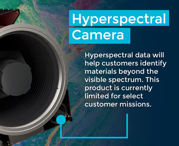
Hyperspectral and Synthetic Aperture Radar (SAR) Imaging (the 2000s – present)
Since then, many new satellites have been launched, each one better equipped than the next with the latest sensor technology money can buy.
Today, you can even see satellites capable of taking hyperspectral images.
Some also come equipped with synthetic aperture radars that can help with all-weather around-the-clock surveillance from space.
What Can Modern Satellite Cameras Capture?
Well, the sphere of satellite camera modeling covers a pretty wide range of fields and topics.
Today, satellites carry a pretty vast array of sensors and use different techniques to take all kinds of images.
To explain it in simpler terms, by using different sensors, satellites collect electromagnetic energy that is bounced off of the Earth.
Passive monitors that don’t need power collect radiation from the Earth and the Sun.
Active devices send out emissions and then measure them after it hits the Earth.
Even though active sensors use a lot of energy to make radiation, they can be used all year and give off radiation that the Sun can’t.
How Do Satellite Cameras Work?
Satellites that are orbiting the earth today all work in different ways that cannot be easily explained.
Here are some of the key aspects of how satellite images are taken and how the whole system operates:
Orbiting Earth
There are different ways and orientations that a satellite uses to orbit Earth.
Besides, it all depends on what the satellite will be used for.
In low Earth orbit (LEO), they are very close to the surface, while in geostationary orbit, they are much farther away.
LEO satellites go around the Earth pretty quickly; it takes them about 90 to 120 minutes to complete an orbit.
So, during each circle, they can take pictures of different parts of our planet.
Imaging Sensors
So, how exactly are satellite images taken?
Satellite cameras use many different kinds of image sensors.
Charge-coupled devices (CCDs) and complementary metal-oxide-semiconductor (CMOS) sensors are two common varieties that detect and measure light.
When it reaches the sensor, an electrical charge is generated, and the charge is subsequently converted into digital information.
Multispectral and Hyperspectral Imaging
You know, satellite cameras are usually equipped with multi- or hyperspectral imaging capabilities.
This means it can capture images in multiple bands of the electromagnetic spectrum beyond what the human eye can see.
Multispectral imagery can be used for things like monitoring vegetation health, identifying different land cover types, and assessing environmental changes.
Onboard Storage and Compression
These cameras are also capable of taking in a large amount of data.
Satellites typically feature internal storage devices to temporarily store the obtained images to fulfill this duty.
So, before they transmit back to Earth, the data is compressed using compression algorithms.
The efficient use of bandwidth is important for improving data transfer.
Data Transmission
The collected and evaluated data is then sent to Earth via radio waves.
Land-based stations receive satellite signals and recover data for future processing.
Information can be sent instantly or stored locally until the satellite is within range of a ground station.
Why Are Cameras Important in Space?
Satellite cameras can have a wide range of uses, including but not limited to the monitoring of the environment, farming, forestry, disaster supervision, planning for cities, military monitoring, and scientific research.
They can collect and share vital data for climate study, resource administration, land utilization strategizing, and immediate surveillance of natural calamities.
Earth-orbiting satellite cameras’ work is extremely valuable for collecting images from space.
The complex sensors in these cameras can be used to get information that can help us identify disasters way ahead of time as well as for some other purposes like monitoring agriculture and ecology among other things.
Satellites have and will continue to change as new technologies are introduced in the future and so will the camera tech used in them.